Shikoku, by Bicycle
A hard, remote, and unreasonably beautiful week of cycling through Shikoku's interior

Intro
Shikoku is the smallest of Japan’s main islands, and the second of four I’m crossing on my cycling trek across the country. It took just five days and 266 miles, barely a tenth of my total route, yet I find myself returning to it far more often than its share of the distance would suggest.
This is a dispatch about the week I spent navigating the heart of Shikoku’s rugged interior by bike. It’s not a comprehensive cycling guide, just an attempt to capture some of what made this island so beautiful and special.
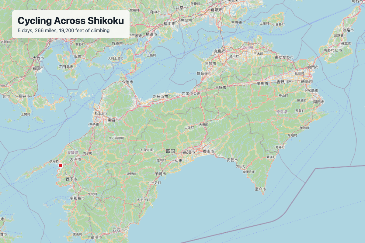
Route design notes are in an earlier post, and GPX recordings are here for anyone who wants the data.
Turning Inland
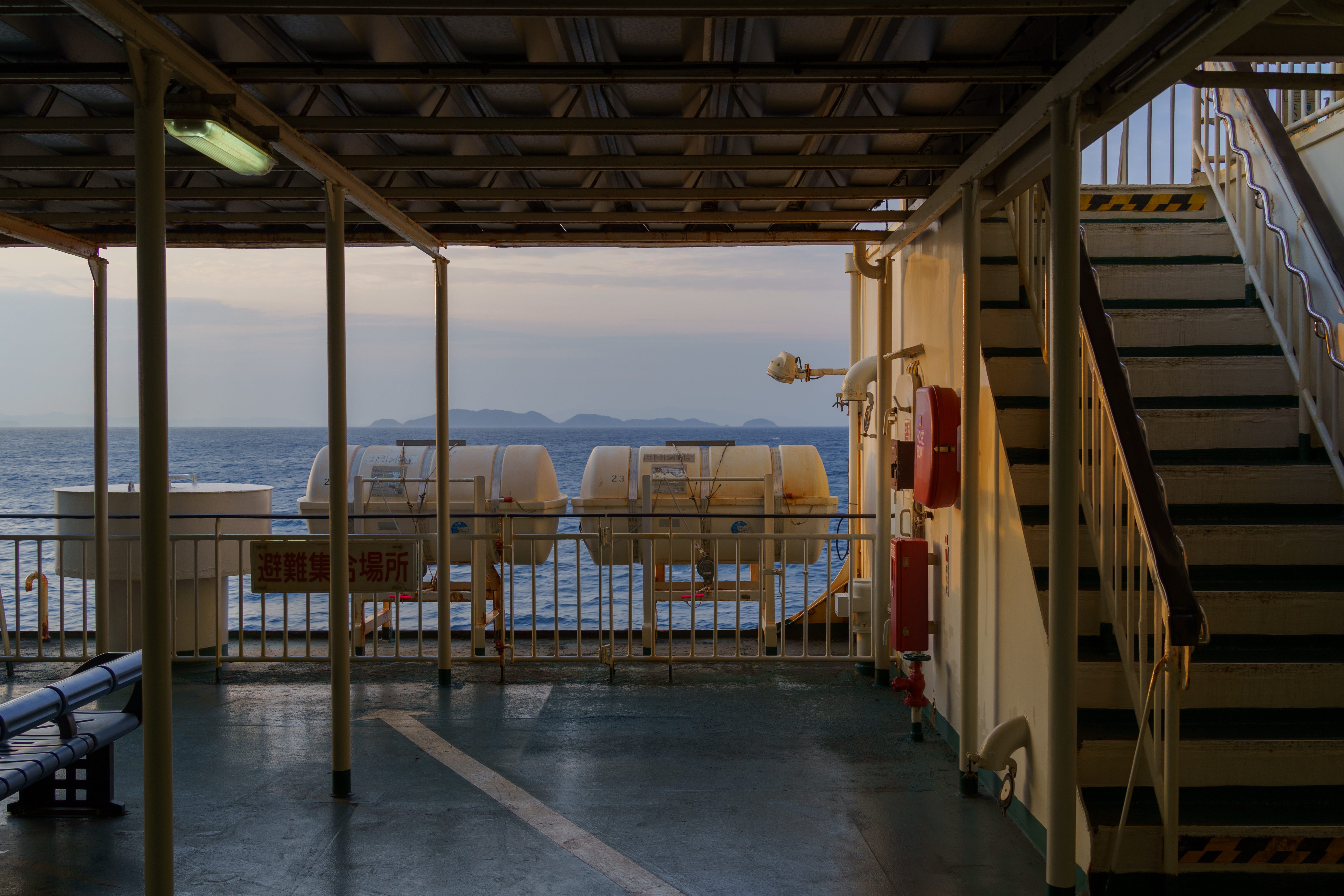
After a rest day spent hopping between the famous Hells of Beppu on Kyushu’s northern coast, I boarded a morning ferry bound across the channel and towards the next island in my journey, Shikoku. I disembarked a few hours later in Yawatahama, more of a small fishing town than the flashing-neon-pachinko-parlor laden tourism city I had left behind earlier that morning.
Unlike most cyclists arriving on Shikoku, I was not there to ride the Shimanami Kaido. This is one of the most famous cycling routes in Japan, and for good reason: spectacular scenery through Setonaikai National Park, following well-supported cycling paths along massive suspension bridges as it hops through a chain of islands connecting Shikoku and Japan’s primary island of Honshu. When designing my route across Japan, I decided to trade a traverse of the Kaido for the opportunity to travel deep into Shikoku’s interior. I’d be swapping the Kaido’s well-trodden cycling paths along coastal plains for something with less margin for error: remote mountain roads, long stretches without services, some of the largest cycling climbs in all of Japan, and a route going through parts of the island rarely visited by cyclists.
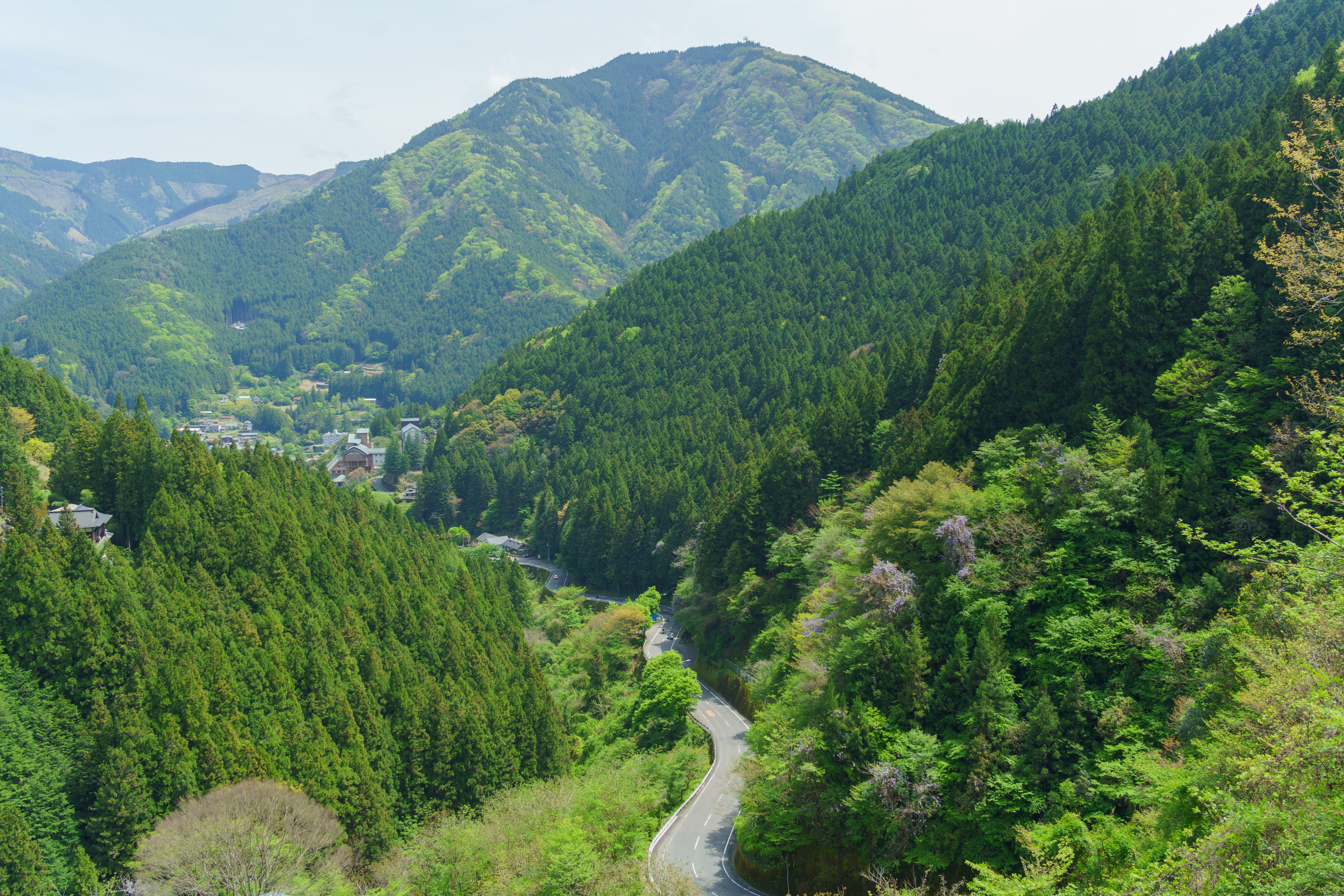
Riding out of the dark hold of the ferry and into the bright afternoon sunlight, I placed the dark green wall of the island’s mountainous interior in front of me and began the day’s ride. With 3,500 feet of climbing over a steep 40 miles, the purpose of this ride was to get deep into Shikoku’s interior in order to effectively stage for the main event of the island: a traverse of the spectacular UFO Line and some of the highest roads on Shikoku.
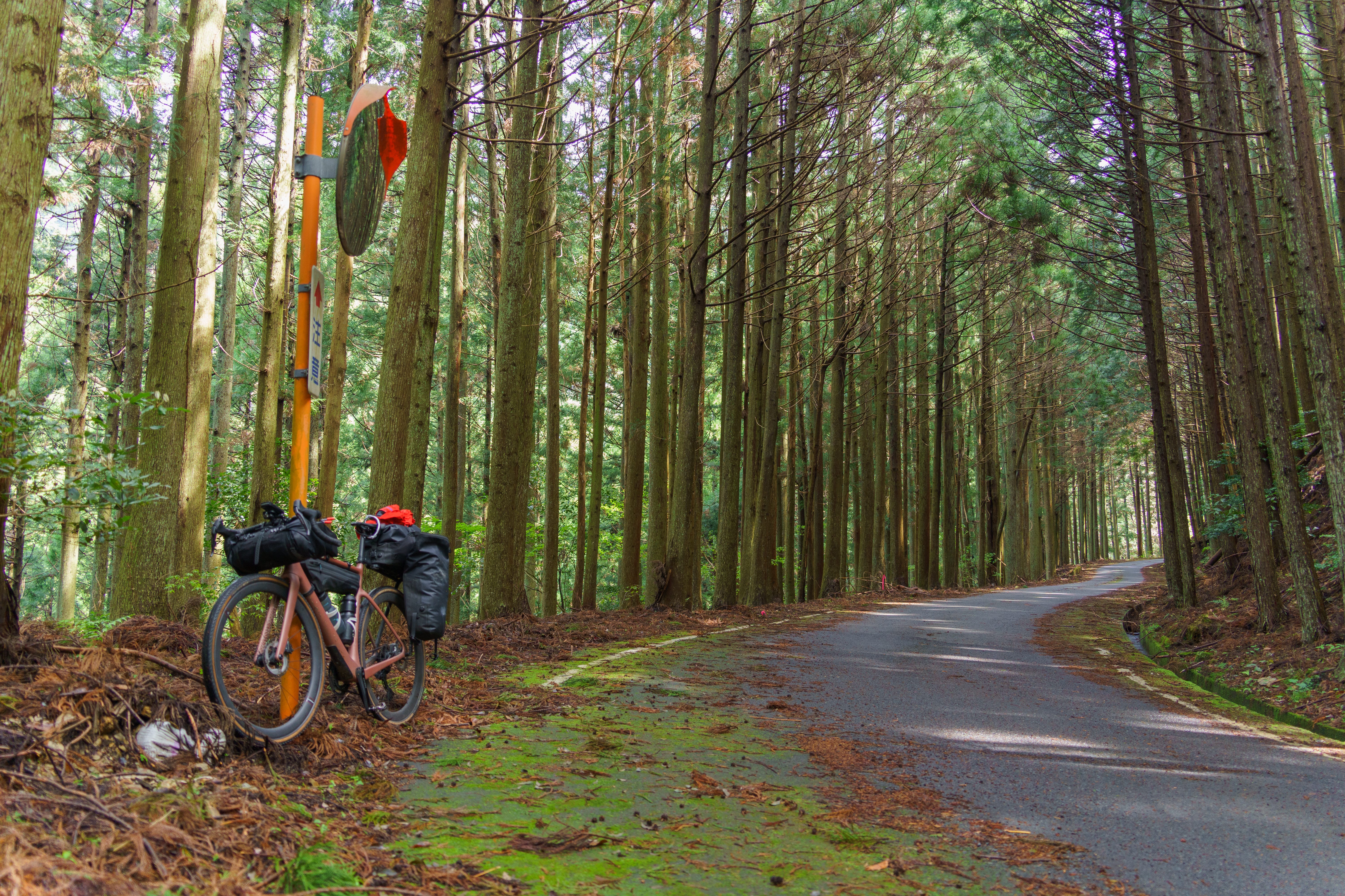
Ascending into the mountains, the footprint of Yawatahama thinned out quickly. Four-lane highways narrowed to two lanes and then to one, sidewalks and vending machines disappeared, and vehicle traffic dropped to almost nothing. The rice paddies I’d grown so accustomed to during my traverse of Kyushu gave way to raw forest which seemed to envelop the roads as I spun along in low gear. After a few hours of cycling, I began passing a new sight for this trip: people walking along the side of the road, with small backpacks, straw hats, and wooden walking sticks. I soon figured out they were pilgrims of the Shikoku Henro, trekking 750 miles between the 88 Buddhist temples which span the length of the island. Shadows grew long across the road as I resisted the temptation to explore every passing curiosity and tried to maintain momentum along the steep climbs.
Arriving into the mountain town of Kumakogen around nightfall, I detoured past two dark “supposedly open” restaurants before settling for a konbini dinner of onigiri and croquettes at the town’s FamilyMart. This specific FamilyMart would be the last convenience store I’d see for the next 80 miles of cycling, unbelievably sparse by the standards of Japan, and so I loaded up on calories accordingly. I departed with my jersey pockets stuffed with chewy candies, canned coffees, and IN Energy gels, and a collection of non-perishable cake-like treats lashed down haphazardly to the exterior of my cycling bags. Rushing through this final climb to maintain body temperature in the cooling forest, my hotel appeared out of the dark woods as the first illuminated building I’d seen in the miles since leaving town. I checked into my room, one still boasting of the countless cigarette smokers it had hosted since the hotel was built in the Shōwa era, quickly gave up the task of uploading footage after seeing the hotel’s WiFi was operating at speeds also era appropriate, and knocked out quickly in anticipation of the next day.
The UFO Line
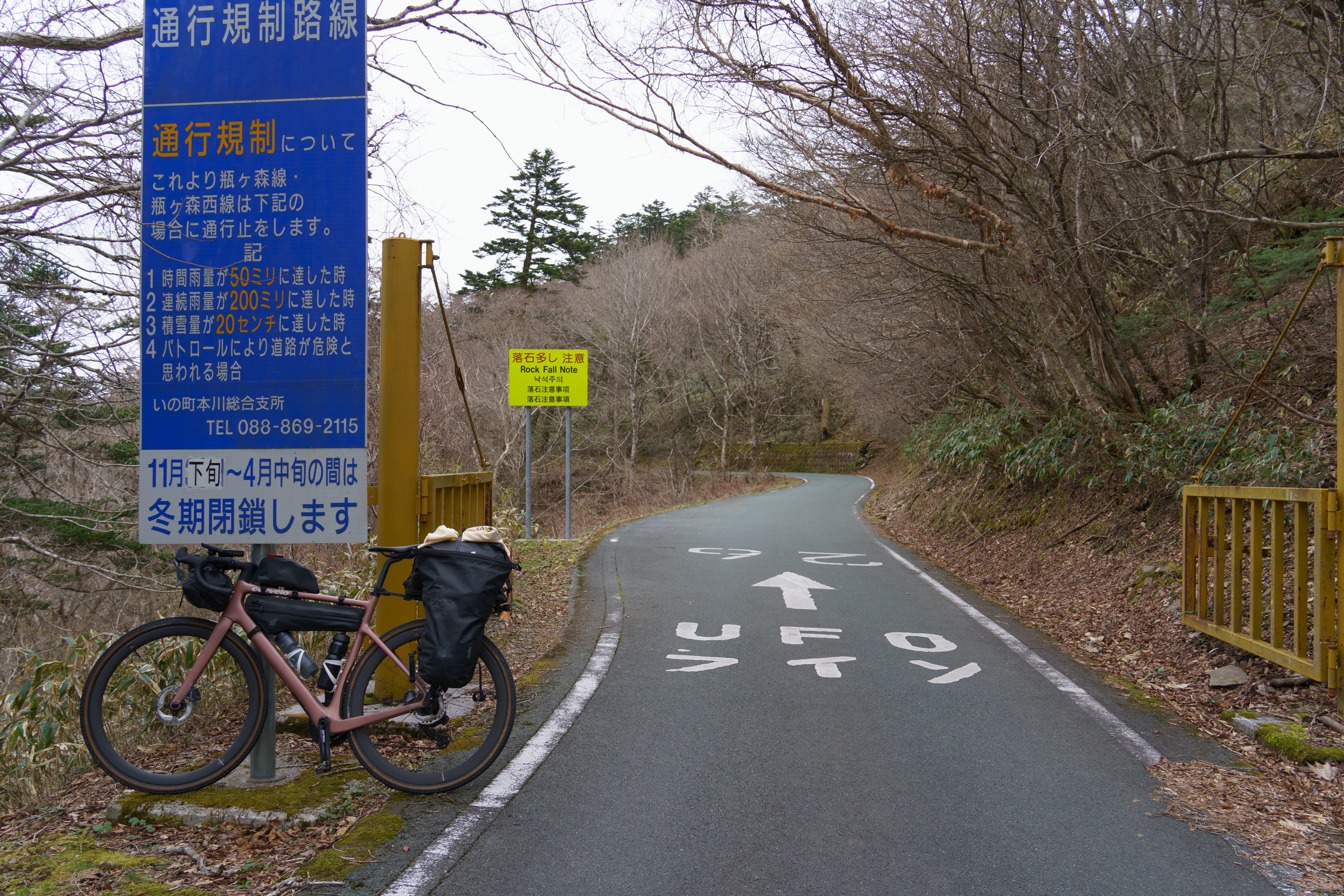
Moving slowly through the first cold morning I’d experienced since landing in Japan a few weeks prior, my intended 7am start slipped first to 8am and then 8:30. I forced down enough electrolyte drink and cream cake to kick off a small bout of nausea in the hotel parking lot before continuing my trek into Shikoku’s interior. After 45 minutes of quick movement along undulating roads a notification popped up on my cycling computer — starting climb: 22 miles, 7,100 feet of elevation gain. That caught my attention.
I was starting my ascent to the UFO Line, a 17 mile stretch of exposed road which hugs the central spine of the island, popular with driving enthusiasts for the road quality and the views it provides in all directions. Ascending to this line would require completing the largest climb I’d ever attempted, and I estimated I’d make it to the summit around 2pm if I managed to maintain momentum. This was relevant because the end of the UFO Line marked only the halfway point of the day, and I needed to make it 72 miles to my hotel by 8pm or risk finding out what precisely was meant by their “latest possible check-in” policy.
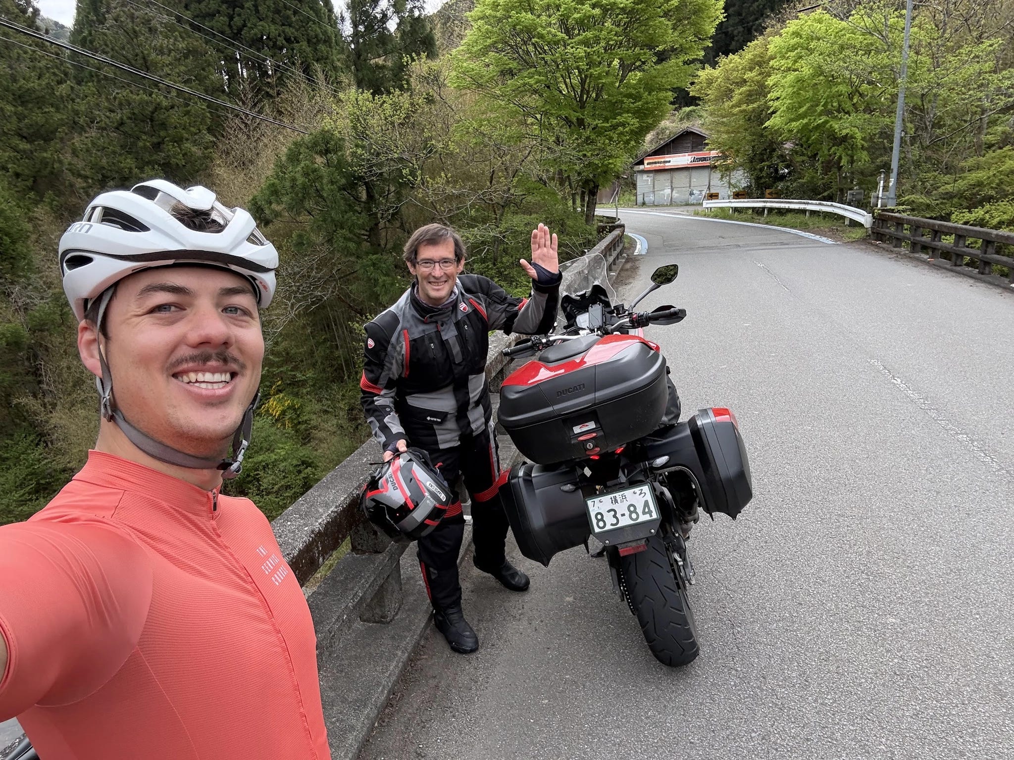
A few miles into the climb, I stopped on the side of a bridge to rest while taking in the scenery when a rare passing motorcyclist stopped right in front of me. Expecting a potential scolding from a local for partially blocking the road, I was greeted instead by a friendly smile and a “hello!” in a vaguely German accent. Boris was on leave from his job and rented a motorcycle to travel across Japan for a few weeks, starting in Tokyo and looping around the southern islands according to no itinerary in particular. We talked about aspects of Japanese society that westerners tend to single out for appreciation (cleanliness and high baseline trust, namely) before moving onto a discussion about work, savings, vacation, and travel. He was happy to hear about my decision to quit my job, and expressed joy at the idea of me having three months to wander the country by bicycle without much of an idea as to what would come next in my career. The conversation meandered through the classic travel topics; the purpose of saving money, how to find more time to travel in a busy life, and how quitting a job can feel scary in the moment but is rarely a mistake in hindsight. He drove off after a firm handshake and genuine well wishing, quickly receding into the distance at speeds I could barely dream of while I picked up to a laughably slow 5mph and continued my climb.
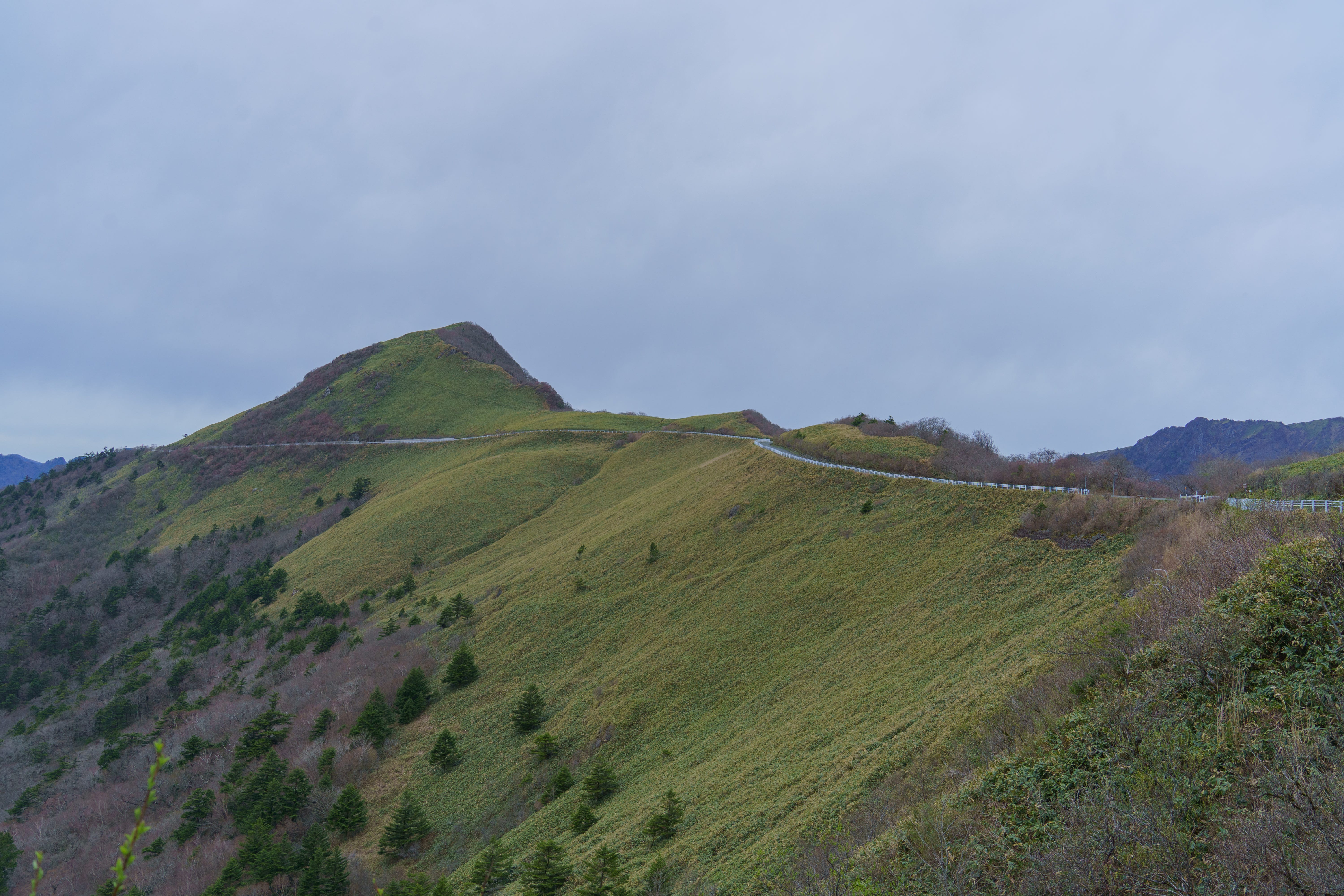
I rounded the first summit a bit after 2pm, drenched with sweat on an otherwise chilly day and a bit delirious from the sheer volume of energy my legs had expended over the last few hours. I spotted a Montbell store with an “open” sign dangling in the window and wandered over, hoping to partially replenish the calorie stash which I had entirely emptied during the ascent. Expecting to maybe find a small selection of Cliff Bars, I was instead greeted by an active food counter selling hot coffee, cold beer, and hot dogs made of local deer meat. I devoured two hot dogs to start, and then a third, while staring out at the landscape through the windows, still surprised my body was actually able to complete the climb. I would have been content to sit there for the rest of the afternoon taking part in what could be described as the world’s least exciting hot dog eating contest, but I was keenly aware of the afternoon slipping away and my arrival deadline approaching. Soon after leaving, I crossed through an open gate and over the giant characters “UFOライン” painted on the asphalt, marking the official start of the UFO Line itself.
The road widened a bit and the surrounding forest dropped below the railings as views into the distant reaches of the island opened up in all directions. Except for the handful of local mountain peaks jutting off of the line itself, all I could see were nested layers of forested ridge lines, each devoid of any signs of human activity. No farms, no hotels, no ski lifts or other pieces of modern infrastructure, just raw Shikoku forest. Not since starting my cycling trip at the southern tip of Kyushu had I had this uncanny sense of embodying a moment I had spent so much time thinking about. Here I was, gliding along this famous ridge line, awash in the satisfying sense of rugged solitude earned under my own leg power.
After an hour-long traverse, I rode across another set of large characters painted across the asphalt. This marked the end of the UFO Line and the start of the back half of the day — 5,000 feet of descent across 30 miles of roads winding even deeper into the island’s interior. This would be not only the longest descent I’d ever done on a bike, but the longest descent I’d ever even heard of in my cycling career. I expected it to be a just reward for the brutal climbing it took to make it here from the coastal port of the previous morning. The descent was comically long, and the initial relief of not needing to pedal gave way to pain in my hands and forearms as I rode my brakes hard to manage speed. The initial joy of exchanging hard-won potential energy for quick forward progress was replaced with mental fatigue from needing to analyze the oncoming path for obstructions, washouts, and potholes.
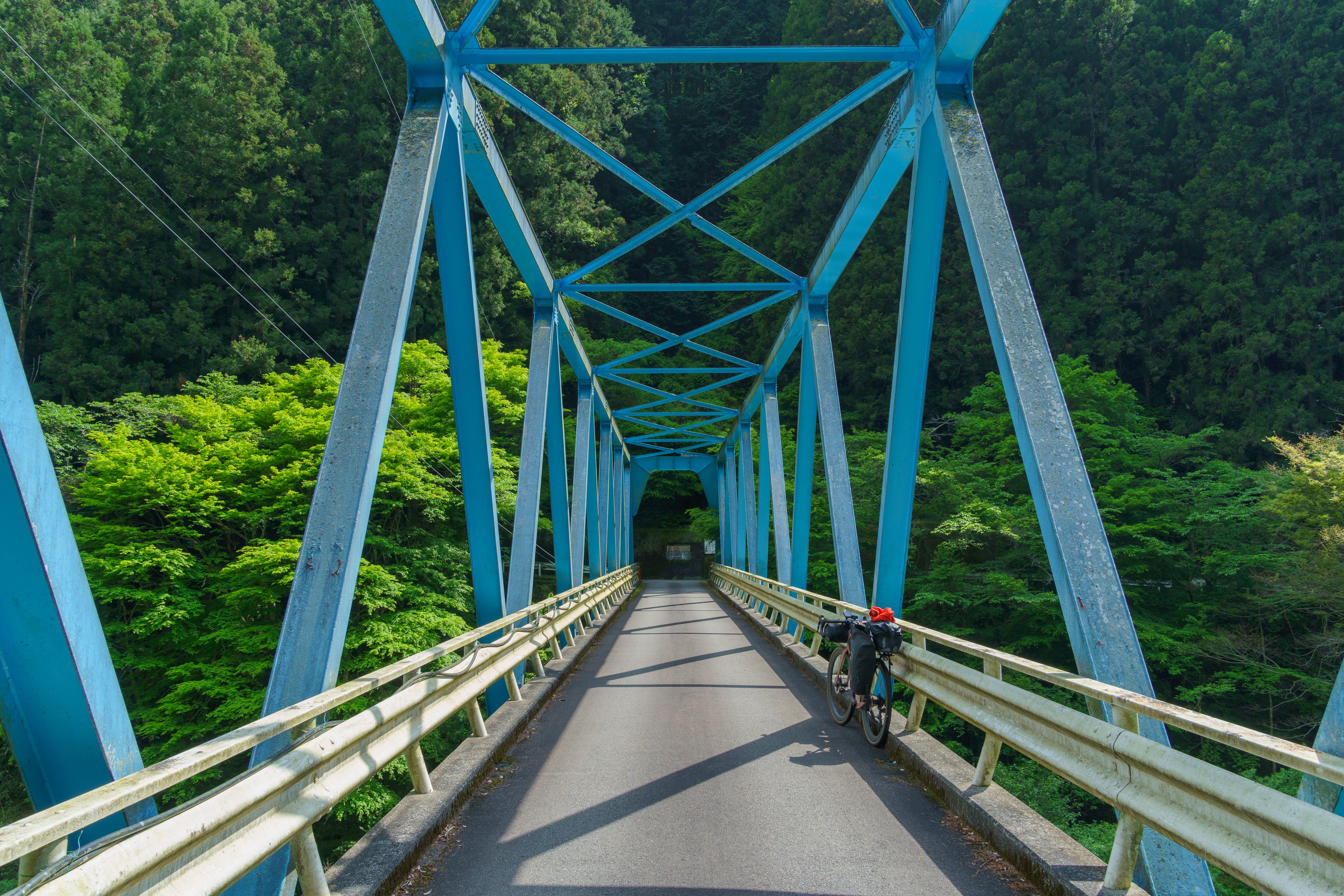
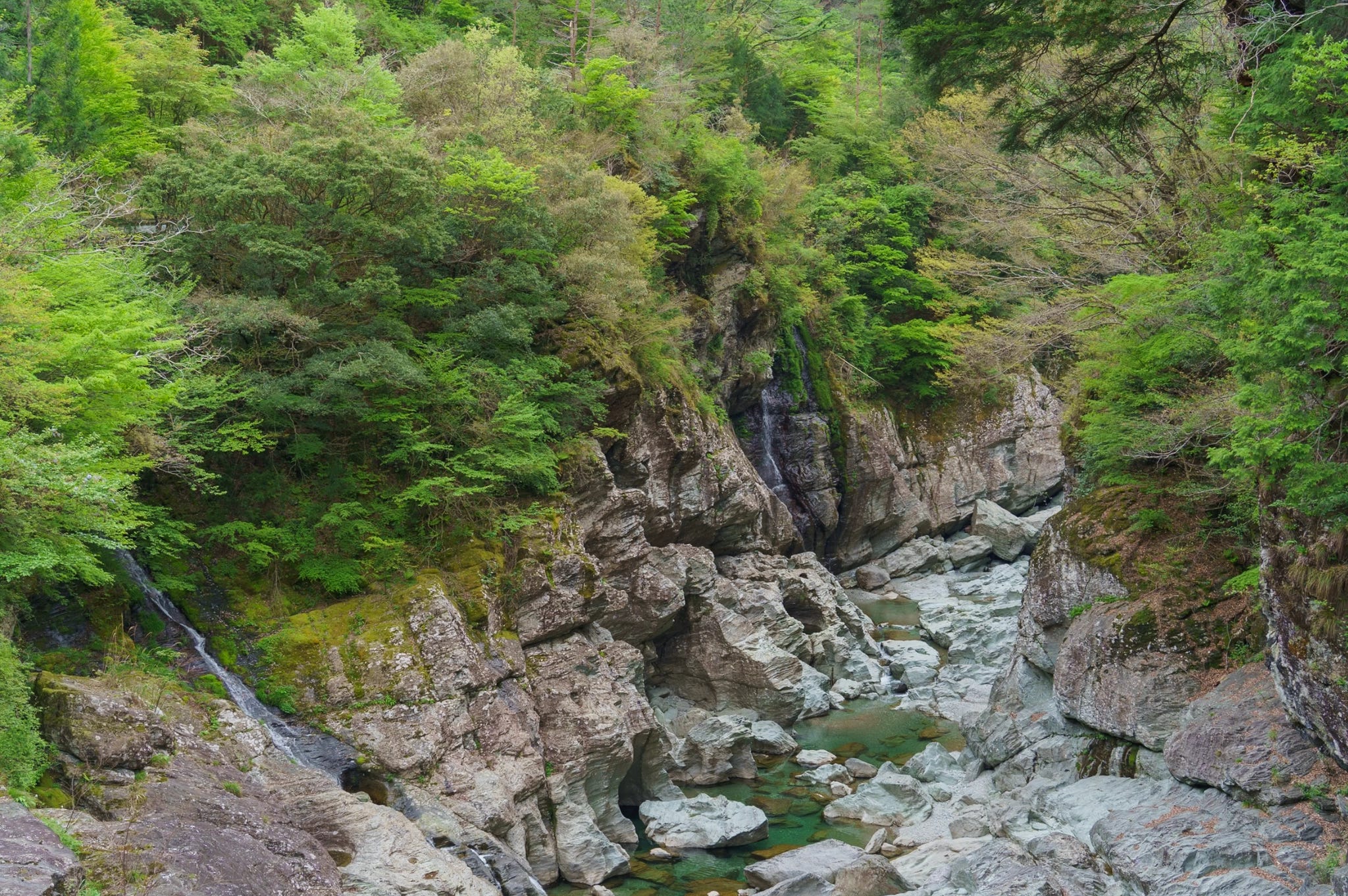
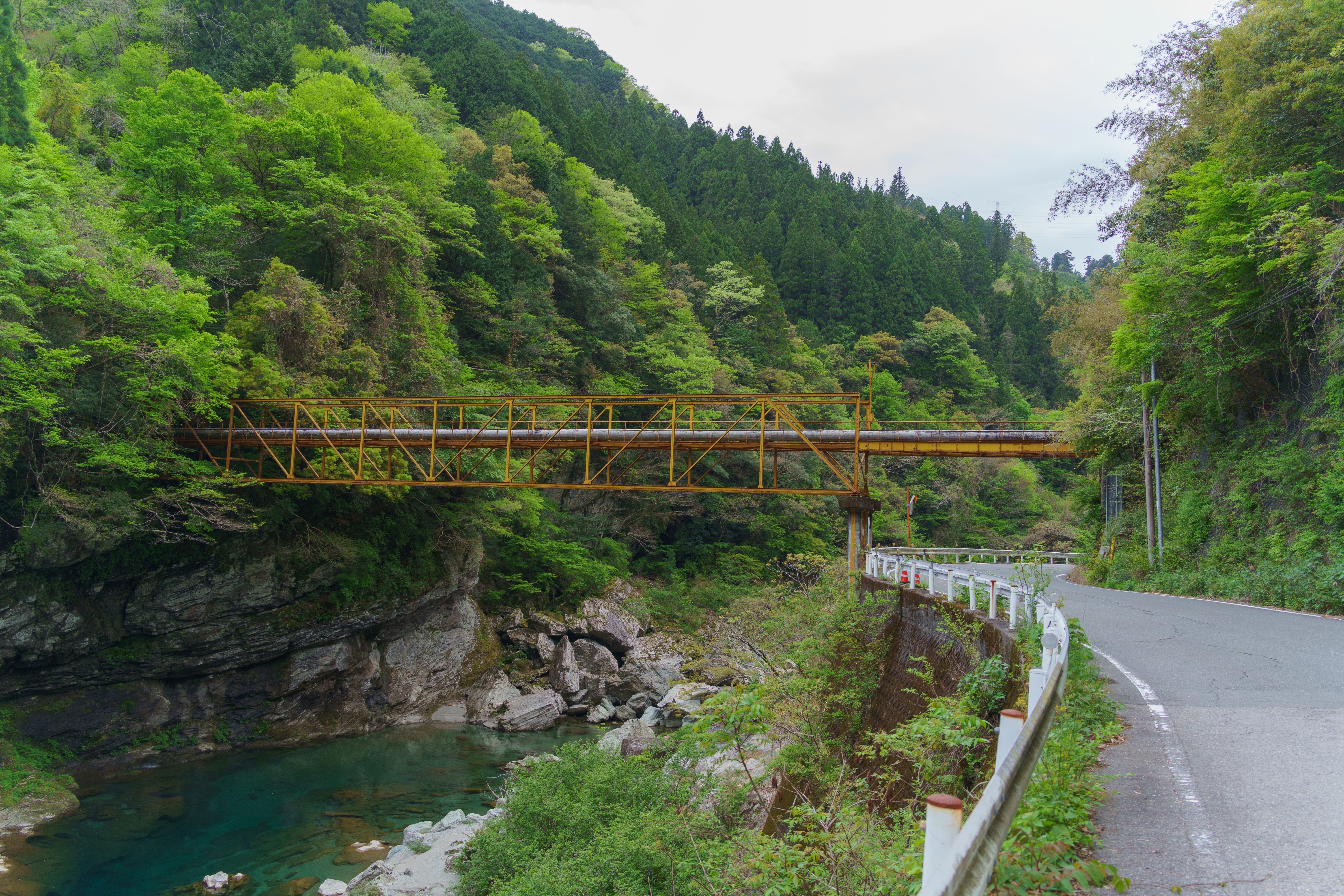
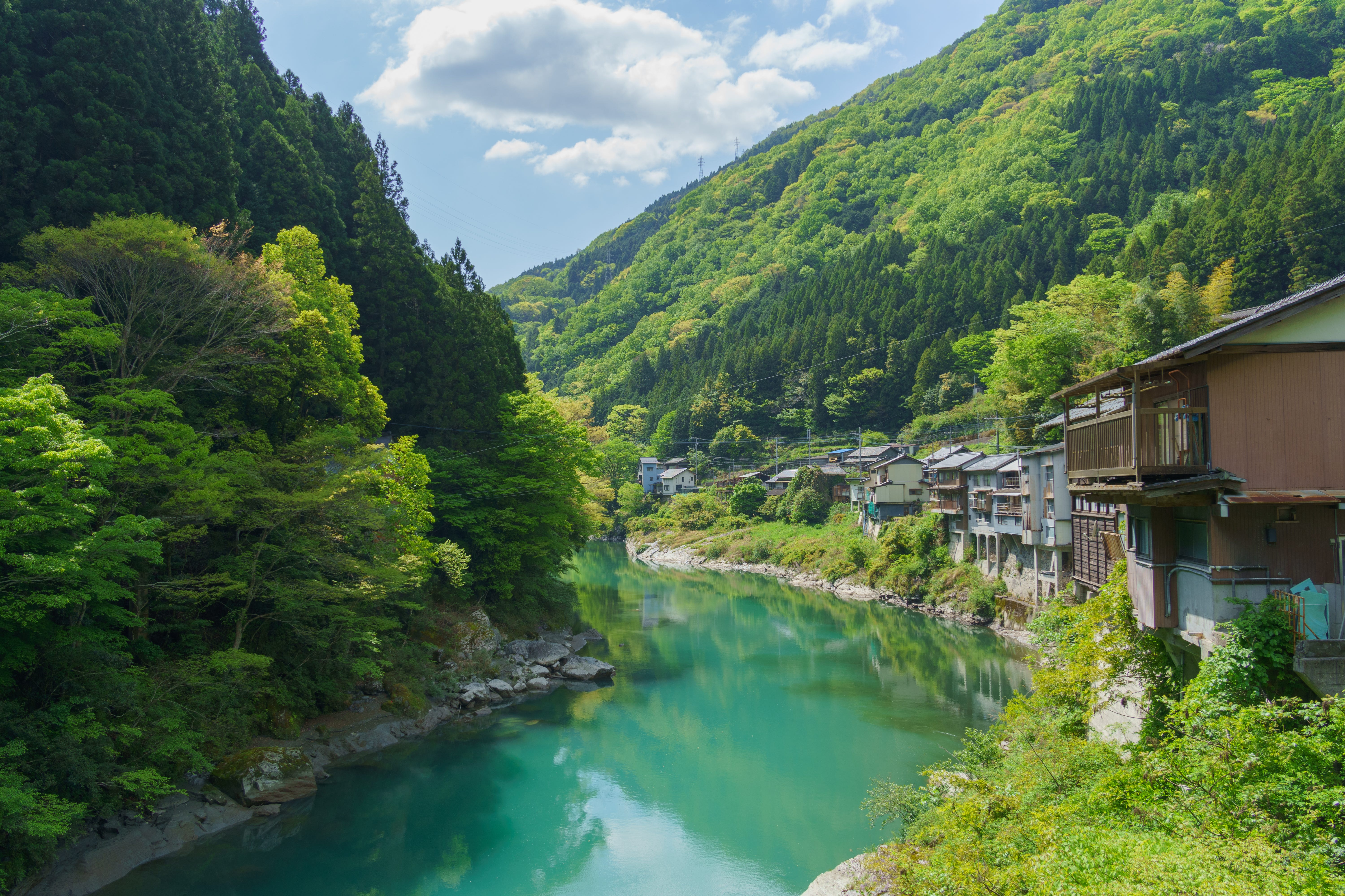
To the relief of my forearms and brake pads, the road gradually leveled out as I left the heights of the ridge line and descended into the surrounding valleys. I eventually turned off the forest road I’d been following all day and onto Highway 17, an official-sounding name for a single-lane road that greeted me with rusted road signs and abandoned buildings. The road clung to the wall of a river gorge for the next 20 miles to Motoyama, separated from the water below by guardrails of questionable integrity.
As I progressed, tributaries joined the river and the gorge opened deeper around it. Boulders, large enough to induce a sense of vertigo when stared at, dammed parts of the river, and the vegetation line 30 feet above the water hinted at the incredible floods this place must see in wetter seasons. Rusted outcrops of collapsed steel bridges and old tunnels, remnants of previous versions of this road, peeked out from beneath the forest’s slow reclamation. The landscape here was as lush as anywhere I had ever been, and I bled precious time from the late afternoon by stopping to marvel at the myriad waterfalls spilling off of the high cliffs and into the depths of the gorge.
By then, the energy from the deer hot dogs was long gone. The day started announcing itself through my sore muscles, aching contact points, and increasingly sloppy focus, and every photo stop became a little harder to restart from. This moderate, picturesque downhill somehow felt more taxing than the headliner climb from that morning.
After a grueling last hour coasting via headlight and counting down the passing fractions of mileage left, I arrived at the check-in desk for my cabin just before cutoff. I was wearing every one of the 72 miles of cycling in expressions of exhaustion on my face and slight grunts of pain as I waddled through the lobby. The polite hostess at the desk pretended not to notice how close I was to missing my deadline and checked me into my room for the evening as if nothing was amiss.
Technical note — the climb ended up being 5,500 feet and not 7,100. My cycling computer lacked knowledge of a few tunnels which cut through, rather than over, mountain ridges.
Oboke Gorge and Iya Valley
I awoke in Motoyama to housekeeping knocking on my door. I had accidentally forgotten to set an alarm before passing out and my body was more than prepared to sleep until noon if not for this disturbance. After rushing to collect my things and change into cycling clothes, I stepped outside to the sight of rain blanketing the town. This was not my ideal morning.
I slowly booted up at a local cafe over two flat whites and as many slices of cheesecake through late morning and finally came to accept the fact that the rain was not letting up any time soon. My short jaunt down the valley would be done in fogged-up glasses and wet cycling shoes.
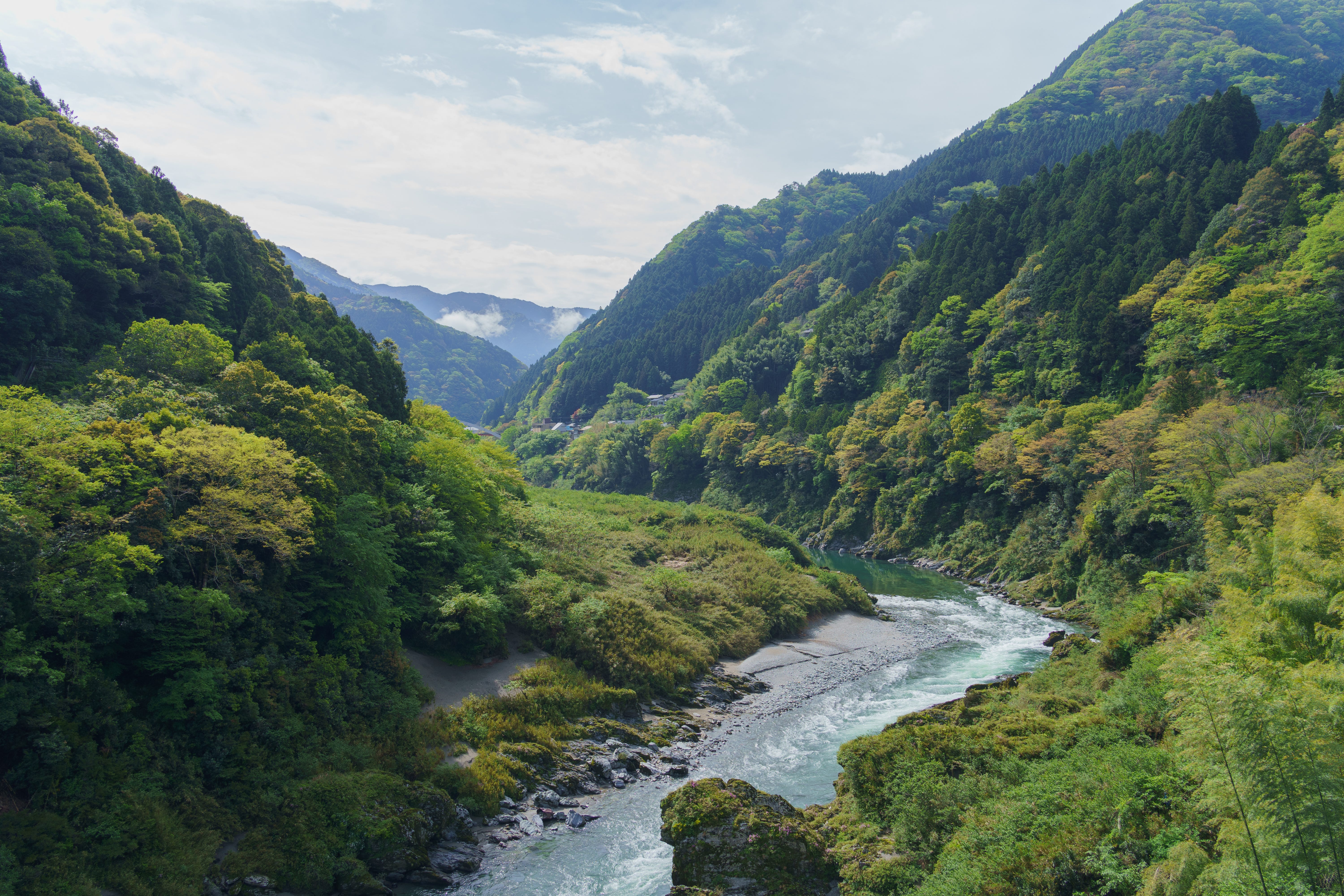
The 20 mile trek led me to Oboke Gorge, a collection of buildings more resembling a fancy rest stop than something most people would consider a town. The last few days of cycling had caught up with me and I was running a laundry, protein, and sleep debt, so I’d be checking into an onsen hotel for a rest day. I stopped at a cafe/restaurant across the hotel while awaiting the check-in window to open and ordered my first hamburger of the trip. Sitting down at a counter to dive into my lunch, I was forced to do a double-take by the view stretching out in front of me — the actual gorge for which the area is named. This section of the Yoshino river slows and widens dramatically as granite cliffs hem it in on both sides. Above it, a wall of sopping tropical vegetation lifts clean to the ridges high above, the mass of green broken only by the vague outline of a JR train passing through the valley twice an hour. I regretted expending the grandest of adjectives on the gorge of the previous afternoon, which now seemed diminutive compared to the shining glory that was Oboke dropping out in front of me.
3pm rolled around and I checked in to my hotel just down the road, delighted to find the gorge visible from my room. Even more delightful, I ventured to the sub-level of the hotel to use the onsen and found the open-air hot spring built into the cliffs overlooking the gorge. The onsen is far enough below the road to prevent pedestrians from seeing the naked bathers while providing 180-degree views of Oboke’s rushing waters after the full day of rain. I rotated through the sauna, cold-plunge, hot-spring, lounge cycle for the better part of the afternoon before turning in for an embarrassingly early bedtime.
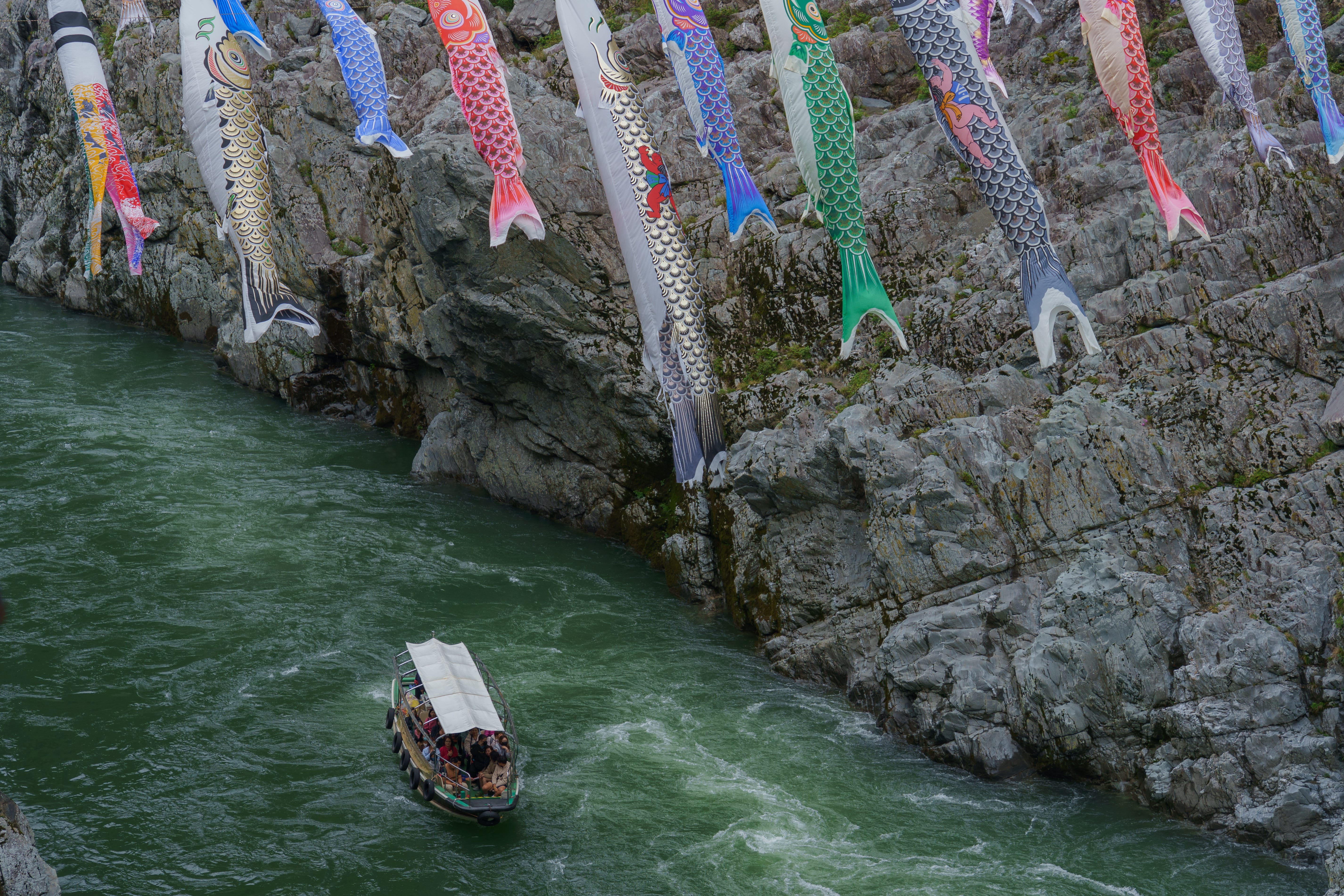
There’s really only one reason why most people come to this area, which is to go on a boat ride through the gorge itself. While looking out of my hotel room window, I saw a steady stream of charter buses unloading tourists in a parking lot at the top of the gorge, where they would line up single-file and descend a long staircase towards the river. Being something of a tourist myself and with an entire rest day on my hands, I decided to partake in the local tradition and venture down to the river’s edge. I was shuffled onto a boat, donned a life jacket, and was serenaded by the odd combination of an insufficiently-muffled motor and a loud tour guide talking the passengers through what I’m sure were interesting details of the gorge’s geology, though of course it was in Japanese and so I did not understand a word of it.
While trying to Google Translate a portion of the tour guide narration, a notification popped up on my phone: GPT-5.5 had just been released. That was the first time I’d been surprised by a model release since before joining OpenAI three years earlier, and was evidence of the intense work that my friends and former colleagues were carrying on in my absence. Memories flashed of the handful of releases I had participated in during my tenure, somehow simultaneously the most chaotic periods of my career but also the most memorable. I swiped away the notification and went back to the translation, which inevitably failed through the muffle of the loudspeaker and noise of the engine.
The sun came out the following day as I was leaving the gorge and I decided to detour through the neighboring Iya Valley rather than take the original direct route to the coast. This would more than double the mileage and climbing total for the day, but it was my last chance to see Shikoku’s interior and was the best weather I’d had in a while, so I decided to make the most of it.
Deciding to avoid a dance with traffic through the mile-long tunnel connecting Oboke and Iya, I instead started my day with a 2,000 foot climb on an old forest road traversing the mountain separating the two valleys. From the top of the climb I could see Iya Valley shining in the morning sun and started what would be an entire afternoon of warm and pleasant descending out to the coast.
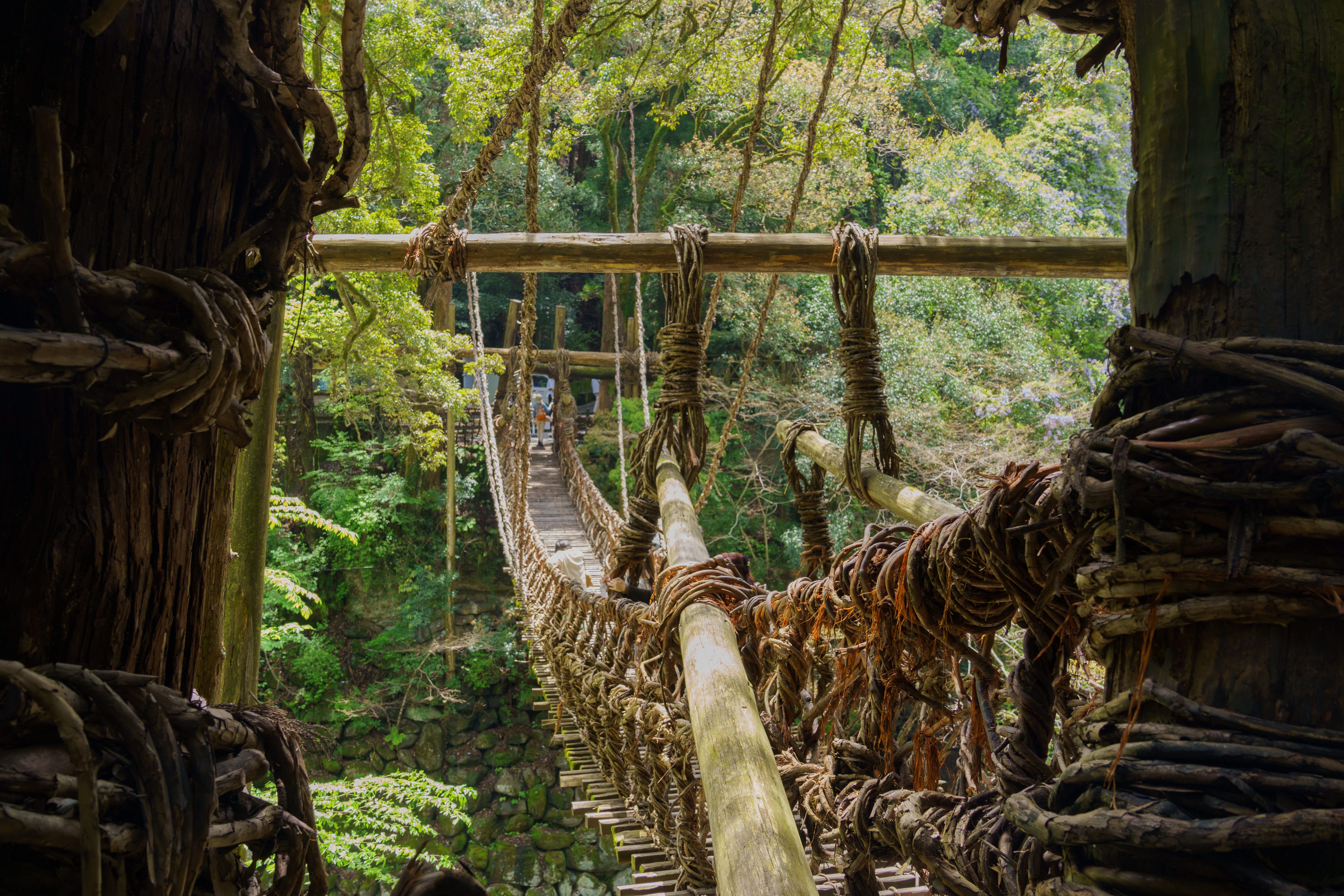
I made a quick stop by the place Iya is most known for — Iya-no-Kazurabashi, the Iya Vine Bridge. This is a long footbridge spanning the Iya River, notable for the fact that it’s made out of foraged vines from the nearby forest and rebuilt every few years as the vines wear out. While I expected a gimmicky experience, the bridge’s height above the valley below and the way it bounced and swayed under the march of other tourists actually made the crossing somewhat exciting, and the construction of the bridge was more interesting to see in-person than I expected.
Before descending out of Iya to join the coast once again, I had one more routing choice to make. I could work my way back to the proper Highway 32, which would be direct, have plenty of services, and be the safest bet for leaving the interior. I had another option — Prefectural Route 32 — a sliver of a road which only revealed itself if you zoomed way in on the map. This was barely a single-lane wide, very winding, and showed evidence of recent closures due to landslides. It would almost certainly be devoid of traffic and would allow me to continue following the scenic Iya Valley all the way out of the mountains. Knowing I ran the risk of hitting a road closure and needing to backtrack, I went with a gut feeling that things would work out and descended along this prefectural route.
The hotel and restaurant footprint of the town quickly vanished and I was immediately tucked into the narrowest road I’d seen on the island. The dense forest buckled over the highway to my right, providing shade from the midday sun. The massive Iya Valley opened up to my left, exposing me to the warm breeze coming up from the lowlands along the coast. I put on a favorite album (Sound of Silver by LCD Soundsystem), settled into the saddle, and felt the uniquely satisfying sensation of starting a long descent which doesn’t end in another climb. I’d stop for the occasional point of interest — a special lookout here, a Buddhist temple carved into the cliff face there, even a semi-famous statue of a child urinating over the cliffs and surrounded at the feet by a pile of yen coins, but otherwise maintained steady momentum as the road worked its way slowly towards the level of the river far below.
Occasionally, you just get a fantastic day without caveats — no rain, looming hotel deadlines, or record-setting climbs. Just a smiling, sweating man and his bike.
Takamatsu and the Inland Sea
I pulled into Takamatsu tired, hungry, and later than I had anticipated. Despite the recent rest day in Oboke, I was absolutely smoked. The cumulative fatigue of not just Shikoku but the 800 miles of cycling I’d done since starting the trip just two weeks prior was catching up to me. Golden Week and six days off of the bicycle was just around the corner, but I decided to take a double rest day in Takamatsu to give my muscles the more than 24 hours they needed to begin recovering. I cleaned up quickly and ventured out into the downtown strip of Takamatsu for dinner, which began one of the more humiliating and confusing sequences of the trip.
Hungry and tired, I was rejected from five different restaurants in a row. I’d open the door, say "hitori desu” while holding up my index finger to signal I was alone, and would be flashed a large “X” made by the crossed forearms of the hostess. At first I thought the restaurants were potentially full, but the last three to reject me had plenty of seats open. While I never got a satisfactory answer (I didn’t want to ask the host to justify their rejection via Google Translate), my hunch is that most restaurants in the downtown strip don’t consider it a good use of space to seat a solo diner on a Saturday night? Exasperated and worried I was either committing some unfathomably grotesque faux pas or had some sort of new and contagious appearing growth on my face, I gave in and had a very sad konbini dinner. Rice balls, potato chips, cream cake, and a full-sugar coke in the hotel lobby at midnight.
Despite the rough start, the next two days were a bit more kind. Takamatsu’s famous Sanuki Udon provided the carb-loading base I needed for energy, while its excellent Ritsurin Garden provided a place to nap in the grass or read my Kindle from the tatami floors of an ancient tea house. I even found the willpower to wait two hours in line for a chance to try Honetsuki-dori, a famous chicken dish of the area. I managed to avoid restaurant rejections the remaining two days and ate meals that I’m still day dreaming of while writing this, a month after leaving Shikoku.
With my double rest day finished but my body only partially recovered, I departed Takamatsu and hobbled along the northern coast of the island. I was bound for the town of Tokushima, where I’d catch a sunset ferry for the next island of my journey, Honshu.
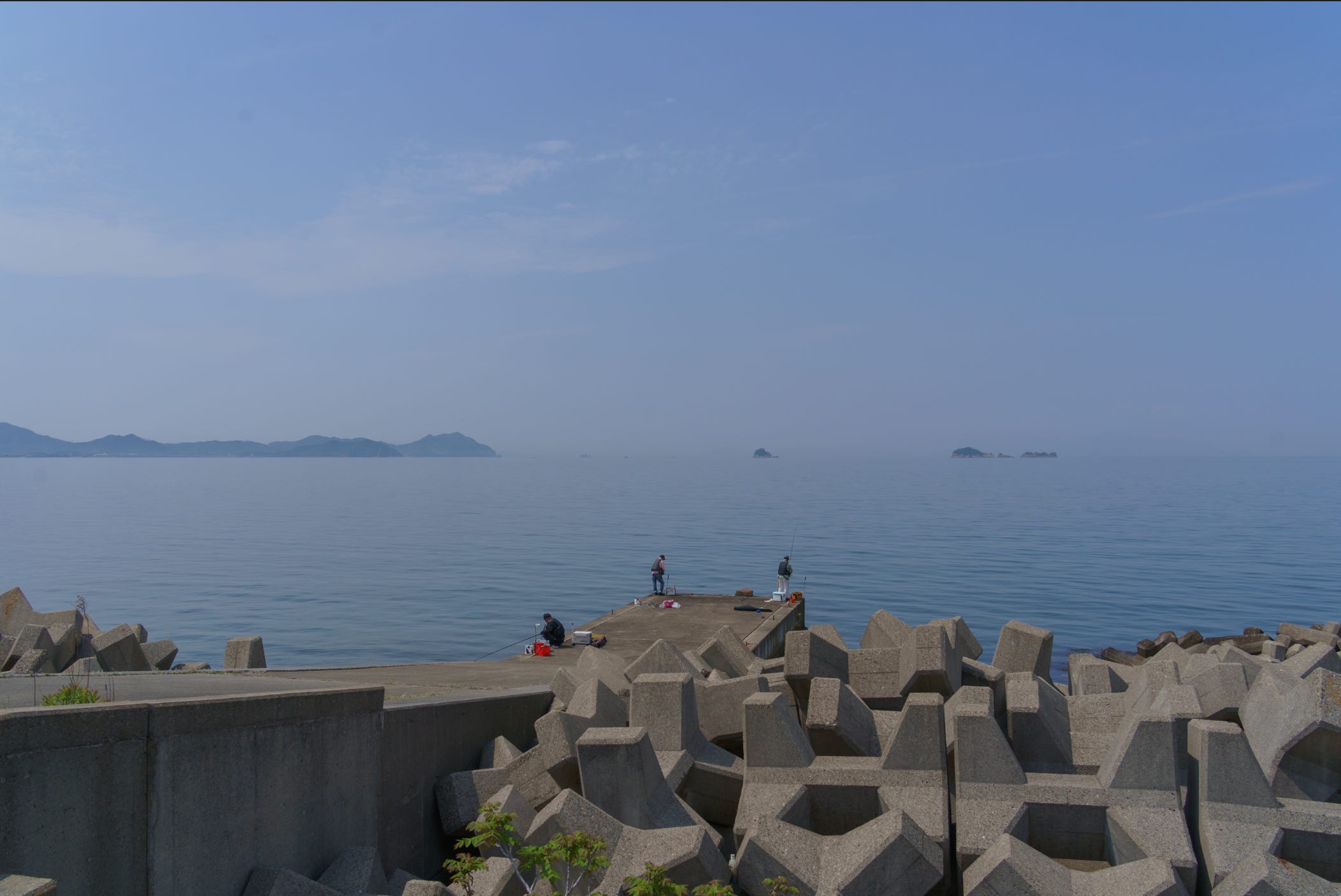
My route hugged the shores of the Seto Inland Sea, the same body of water the Shimanami Kaido traverses farther west. Riding along glass-calm water, with protected bike lanes and an abundance of services compared to the sparseness of the interior, I understood why the Kaido has become such a renowned cycling destination. Shikoku’s interior had given me exactly what I needed from this crossing: an ass kicking, a glimpse into the rugged center of the island, and a week of riding through places I’m unlikely to reach again by accident. But that short ride along the Inland Sea made clear that I had not exhausted Shikoku. I had only chosen one version of it, and someday I’ll need to come back and give the Kaido its proper due.
Northward
It’s been a month and over a thousand miles of cycling since I left the northern shores of Shikoku by ferry. I was worried that some of the texture and detail of the island would have faded from memory in that time, but this specific week in late April sticks out brightly in my mind. I think it’ll be a long time before I forget just how epic it felt to climb over the UFO Line, or the sense of awe that Iya and Oboke inspired.
Shikoku is where I confronted some of the toughest days of the entire trip. That I loved the remote interior, rather than merely surviving it, made me trust I could take on the hardest days still ahead. It’s what pushed me to rework parts of my northern Honshu route to venture even deeper into the mountains than I’d first planned.
I’m writing this from a cafe in northern Honshu, preparing to move on to Hokkaido and the last of the four islands I’ll cross on this trip. With less than 700 miles to go, the end is just barely coming into view. As is the case with the ending of any good thing, the temptation to pre-grieve it is already strong.
P.S. — I’m intentionally staying off of social media on this trip, but if you’d like day-by-day updates, you can find me on Strava uploading my daily rides along with some photos and commentary https://www.strava.com/athletes/33055758